


Sturmey Archer 3x9 dual drive hybrid hub
 06-23-24, 08:25 PM
#76
Senior Member
Looks so cool! I was looking at your suggestions with google maps, and it’s ok but I think we way want a better navigation app once we are there.
and yeah, I’m not sure our 1x9 setups would be the best for northern Thailand, but I imagine we can always ride public transport over the biggest ridges.
and yeah, I’m not sure our 1x9 setups would be the best for northern Thailand, but I imagine we can always ride public transport over the biggest ridges.

Likes For Ron Damon:
06-23-24, 09:35 PM
#77
(above) Maps: It's like an AI assistant but with more personality! Thanks Ron!
OP: Note, those maps highlight a motorcycle icon, not bike. If you divide the hours by the distance, that will probably give some indication of difficulty via motorized vehicle, then multiply time accordingly for bicycle. Quite a distance, and hilly.
I wonder if the small yellow stretches are denoting inclines, or construction?
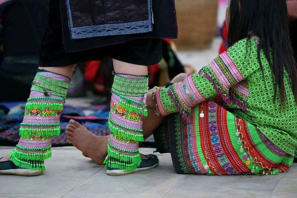
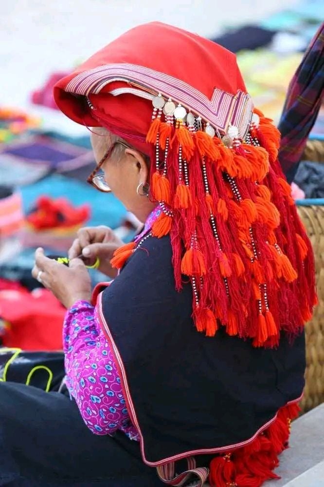
The native clothing colors and patterns are just vivid, lovely.
OP: Note, those maps highlight a motorcycle icon, not bike. If you divide the hours by the distance, that will probably give some indication of difficulty via motorized vehicle, then multiply time accordingly for bicycle. Quite a distance, and hilly.
I wonder if the small yellow stretches are denoting inclines, or construction?
The native clothing colors and patterns are just vivid, lovely.
Likes For Duragrouch:
06-23-24, 09:47 PM
#78
Senior Member
(above) Maps: It's like an AI assistant but with more personality! Thanks Ron!
OP: Note, those maps highlight a motorcycle icon, not bike. If you divide the hours by the distance, that will probably give some indication of difficulty via motorized vehicle, then multiply time accordingly for bicycle. Quite a distance, and hilly.
I wonder if the small yellow stretches are denoting inclines, or construction?
The native clothing colors and patterns are just vivid, lovely.
Yellow and red on the map indicate levels of congestion.
06-24-24, 10:24 PM
#79
Senior Member
Likes For Ron Damon:
06-24-24, 10:36 PM
#80
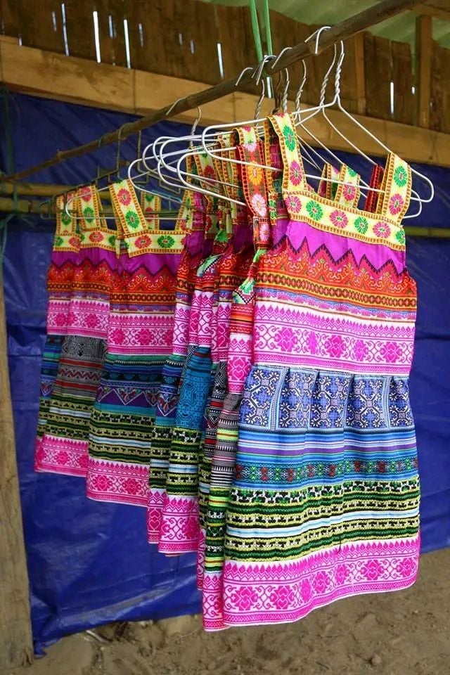
(above) My guess is, back in the day, each family crafted their own fabrics and embroidery. The pic of the hanging rack of them, kinda answers my question, that these days, clothes and fabrics like that can be purchased, which is good, leaves time for other things.
Tropical alpine sounds good to me.
Tropical alpine sounds good to me.
06-25-24, 07:32 AM
#81
Aging hipster
Thread Starter
 06-25-24, 07:41 AM
#82
Senior Member
Likes For Ron Damon:
